Taipei, Taiwan- February 20, 2020
Authorities around the world are racing to halt the spread of the novel coronavirus (COVID-19), by implementing drastic measures such as city lockdown, borders close-down, travel restrictions, among others. On the other hand, scientists are working on developing a vaccine to blunt the outbreak’s impact. However, much is still unknown about the coronavirus, including its epidemiology, transmission patterns, and who is the vulnerable population.
In outbreaks investigations, the “who” and the “when” of a disease are often dependent on the “where.” Therefore, the study of coronavirus infection data in spatial resolution with the population mobility patterns plays a critical role in epidemiologists on understanding its transmission patterns. Through this analysis, they can identify geographically high-risk populations and allocate resources to mitigate risks of the further spreading of the virus. However, the difficulty of collecting reliable location data of a whole country’s population and visualizing it in real-time often hampers these investigations.
Groundhog Technologies, as the leading vendor in geolocation solutions, has substantial experience in overcoming these data challenges by leveraging ubiquitous wireless mobile cellular networks to provide high-quality location data nationwide. Through its Public Health Solution, it enables near-real-time as well as historical analytics and visualizations of population mobility. It can empower researchers to have a holistic view of the outbreak, assess the geographic risk profile, monitor infected people, and reveal infected suspects to dramatically reduce the virus transmission.
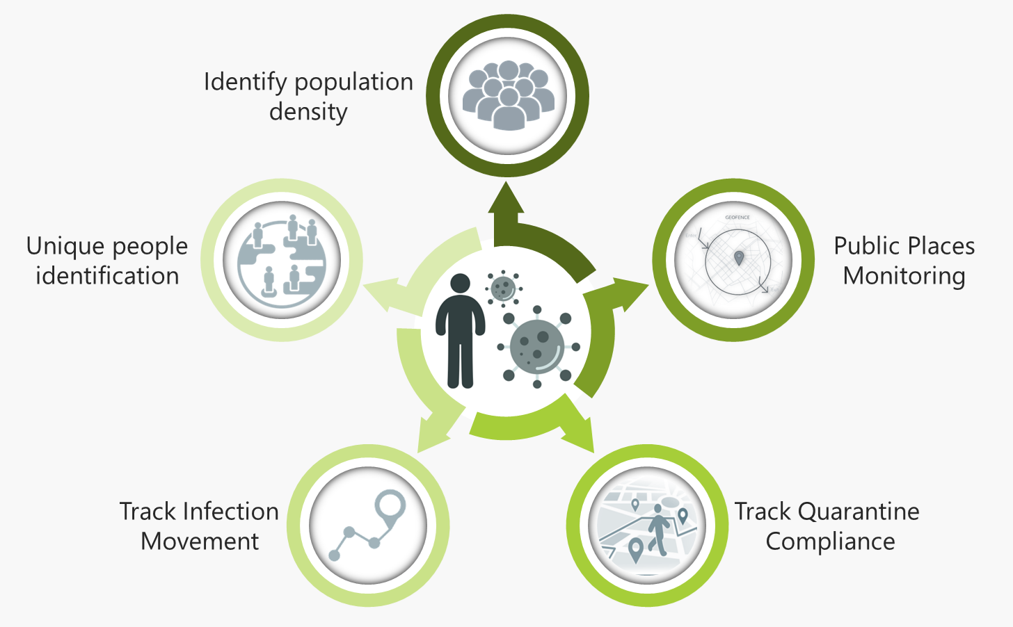
The Public Health Solution allows to:
- Identify the geography of the population density of the infection to assess the severity of the outbreak, categorize geographic vulnerability, and help in allocating the correct number of medical resources for the management of the incident.
- Monitor public spaces densely visited (e.g., malls, temples, amusement parks) to identify if infected people have attended the location, which increases the virus transmission probability.
- Retrace infected people’s movements in the past days to find out the visited locations and list the ones who were in these locations during that period for selected testing and action as required. Likewise, visualize the live flow of infected or potentially infected people as they move.
- Detect and list potentially infected people who reside in the same area of an isolated infected person for the medical support team to test, quarantine, relocate, and monitor suspected infections as needed.
- Geofence quarantined geography and monitor the movements of all people within this area. Automatically detect home isolation and home quarantine violators to alert relevant security and medical teams for action.
- Reveal travelers who come from the country of the outbreak.

The sudden and fast spread of the coronavirus is putting unbearable pressure on governments to control, cure, and prevent a massive number of deaths. The Public Health Solution swiftly delivers a comprehensive spatial analysis of the current coronavirus outbreak to minimize it and prevent the disease from spreading to at-risk communities.
Groundhog Technologies understands the importance of leveraging groundbreaking location technologies to solve the world’s most significant health issues. Stay with us to see where our Public Health Solution heads next to fight the coronavirus. For more information contact us at https://www.ghtinc.com/alliance-request/
About Groundhog Technologies
Groundhog Technologies is the leading provider of Mobility Intelligence. Our solutions can reveal the locations, Quality of Experience (QoE), context, and lifestyles of all mobile users in the operator’s entire network 24×7. This carrier-grade platform continuously transforms billions of daily network events and petabytes of data into ubiquitous intelligence. This invaluable knowledge empowers our partners to improve services and generate new revenue streams by enabling various applications for Geo-CEM, Geo-Analytics, and Geo-Targeting. Since 2001, Groundhog Technologies has been helping the foremost operators in the world to maximize their network and business potential.

